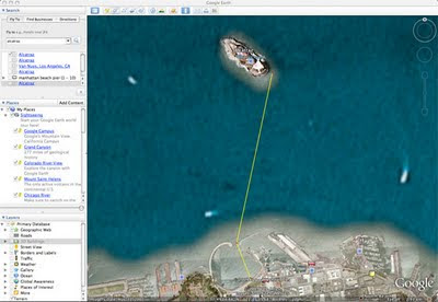
The Alcatraz Sharkfest Swim claims the distance between Alcatraz island and the finish line at Aquatic Park is 1.5 miles. As a crow flies or as a dolphin swims, it is definitely not 1.5 miles. However, if you swim in an arc as the race director recommends or you are thrown off course like a cork in a tempest like I was last August, it probably is a 1.5 mile swim.
Kerry, a SCAQ Blog reader and swimmer, who loves to tell me when I am wrong especially when it comes to "sacred cow" subjects like tech-suits, insisted that the distance that the Sharkfest promoters claims is way off and that it can't be more than a mile.
So, using the free Google Earth application, I was able to plot the exact distance; (if my faith in the Google satellite imaging data is correct), by using the ruler tool to calculate the exact path.
The distance between Alcatraz and the finish line at Aquatic park in 1.25 miles
Here is a quick overview how to do it
You use the RULER icon and select PATH from the pop-up menu. Then "click" each point of your swim path, bike path, run path, on the actual map and the total distance will appear in the in the RULER POP-UP panel!
Way cool!

No comments:
Post a Comment